Rip Rap Servicesin Oxford MI
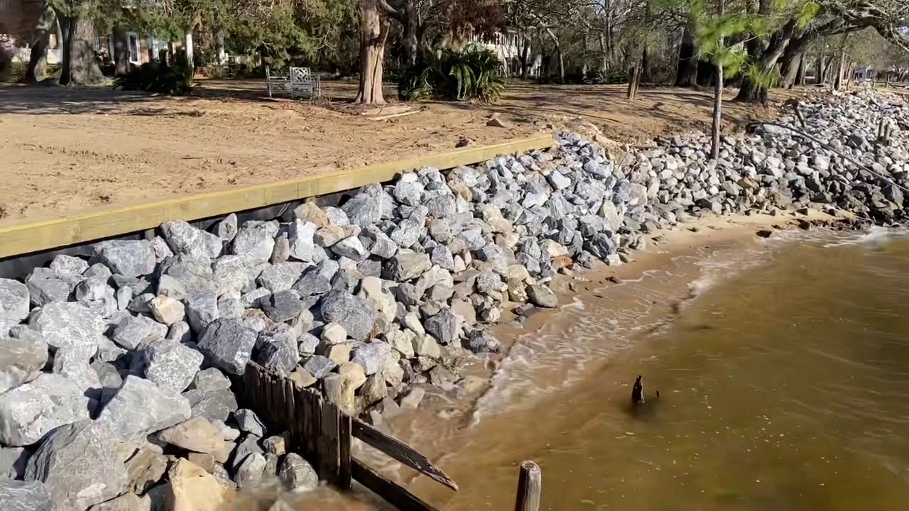
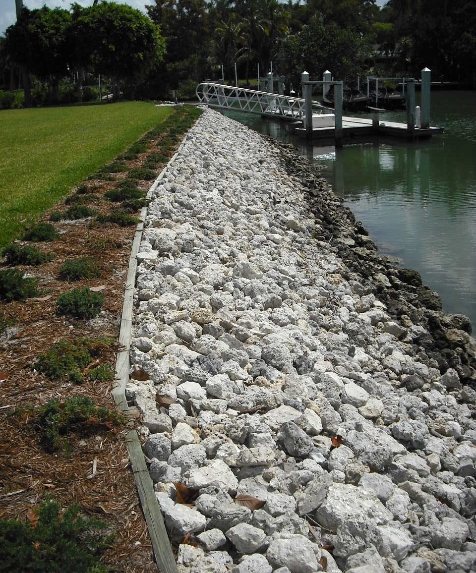
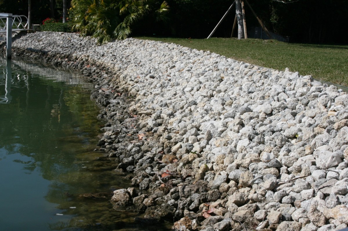
Rip Rap Placement to Protect Your Shoreline from Erosion
We Are Locally Owned & Operated For Over 37 Years
Contact Us Today!
We Serve Businesses In And Around The Following Cities:
About Rip Rap Services
Introduction to Rip Rap in Oxford’s Commercial Properties
As a burgeoning commercial property owner in idyllic Oxford, you might wonder about an environmentally friendly solution to soil erosion woes in your locality. Enter Rip Rap, a lesser-known but robust response to a longstanding problem. As a potent form of combat against soil erosion, Rip Rap is worth considering for safeguarding your commercial properties in Oxford. As mundane as the notion of soil erosion may sound, it’s a significant consideration, especially in areas susceptible to extensive rainfall or shoreline spaces vulnerable to water erosion. By using Rip Rap rock, you are not only protecting your property but contributing to an ecologically responsible solution
Understanding Rip Rap: Process and Applications
The process of implementing Rip Rap begins with detailed planning. This involves the precise selection of riprap rock to suit the area, as coarse stones most commonly used render several benefits. Among the most valued benefits of stone Rip Rap includes its flexibility for use in a variety of settings, including commercial driveways, culverts, and more.
The procedure begins with careful evaluation of your commercial property, followed by the active application of Rip Rap stone. Using the services of professionals, such as those at D&J Contracting, ensures meticulous adherence to best practices, aiming for efficient erosion control with Rip Rap rock. This procedure can be utilized in various commercial property environments, including a rip rap ditch to ensure long-term stability and water control.
Rip Rap Rock: A Beneficial Measure for Commercial Properties
For Oxford’s commercial property owners, the rip-rap discipline comes forth as a boon in several ways. One of the prime benefits lies in its effective erosion control properties. With carefully placed stone Rip Rap, the menace of soil erosion can be significantly minimized. This goes beyond mere soil protection and extends its merit to maintaining the aesthetic quality of the property.
From rip rap stone near your pond to rip rap rock strategically placed in the ditch, this use of landscaping rip-rap improves the overall appeal of the commercial property. This is indeed a win-win scenario, where utility and beauty are maintained simultaneously. As a case in point, a lake rip rap can serve as an erosion control measure along the waterfront while also becoming a visual delight for onlookers.
Localized Application in Oxford
Oxford’s distinctive architecture and setting provide various scenarios for the practical application of Rip Rap. Maybe a Rip Rap driveway near the Oxford University campus or a rip rap culvert near Oxford’s plethora of parks. In each case, Rip Rap proves itself as an effective solution for erosion control while enhancing the landscape.
Taking an example of an Oxford-based commercial property, consider a rip rap rock driveway or even a beach rip rap. By implementing this solution, you uphold the city’s visual appeal while ensuring long-term protection against the bane of soil erosion. D&J Contracting, with its expertise in local terrain and soils, can seamlessly integrate Rip Rap into your property, ensuring the synergy of structure, sustainability, and visual pleasure.
Rip Rap: An Investment for the Future
Grasping the interconnected nature of environmental elements is increasingly critical in our era and implementing a robust solution like Rip Rap reflects this understanding. Beyond the immediate benefits of erosion control and property beautification, Rip Rap is a sound investment that benefits future generations.
Whether you employ landscape riprap around your property or install rip rap rock in a ditch, the financial and ecological benefits are considerable. Collaborating with organizations such as D&J Contracting allows you to tap into these advantages more efficiently and sustainably, setting in motion a future-focused chain of benefits.
Ensure Your Commercial Property’s Longevity with Rip Rap
After gaining clarity about the process, benefits, and applications of Rip Rap, it becomes apparent how this practice can be an advantageous, ecological friendly measure for commercial properties in Oxford. From a rip rap rock driveway to implementing it in ditches, ponds, and shorelines, Rip Rap opens up a world of potential solutions for erosion control.
A partnership with a proficient contracting service like D&J Contracting helps you get the most out of this technique, creating an environmentally friendly, aesthetically pleasing, and erosion-resistant property. So, take the plunge and secure your commercial property’s aesthetic appeal and longevity with Rip Rap, while simultaneously making a durable investment for future generations.
Rip Rap Services Gallery


Call Us Today to receive your Free Quote for
Rip Rap in Oxford
Serving: Oxford, Michigan

About Oxford, Michigan
During the early 19th century the northeast Oakland County area was largely avoided by the early settlers because it was believed to be nothing but impenetrable swamp land. The area was, at that time, nicknamed “The Barren Plains of Oxford.” It was called this primarily because of a report made in 1812 by the U.S. Surveyor General that described the area as a poor, barren, sandy land, on which scarcely any vegetation could grow with the exception of some very small scrubby oaks. It was concluded in the surveyors’ report that there was one acre out of one hundred that appeared to be eligible for cultivation. Any hope for crop production was thought to be preposterous. At this point, the area was deemed worthless, and discouragement of any hope for development by forthcoming settlers was inevitable.
Purchase of public land in what is now called Oxford was in 1823 by a man named Elbridge G. Deming. Soon after, the first person to settle in Oxford was a wolf trapper named Avery Brown. He made use of the land and gave some credibility to its value. It wasn’t long after that the first area post office was officially established in what was then known as Demingsburgh on May 2, 1834. Five years later, the name was officially changed to Oxford on January 15, 1839. Elbridge D. Deming was the first postmaster for Oxford, as the post office was located in his log home near the intersection of M-24 and Metamora Road.
On November 30, 2021, a mass shooting occurred at Oxford High School. Four people were killed, and seven others were injured, including an injured teacher. School attendance was very low that day, as rumors had spread earlier that week of a shooting being about to occur. Most of the students escaped into a nearby Meijer. The suspect, a 15-year-old sophomore student, reportedly fired between 15 and 20 bullets in a chemistry room and did not resist arrest.
According to the United States Census Bureau, the village has a total area of 1.46 square miles (3.78 km), of which 1.26 square miles (3.26 km) is land and 0.20 square miles (0.52 km) (1.37%) is water.
| Census | Pop. | Note | %± |
|---|---|---|---|
| 1880 | 851 | — | |
| 1890 | 1,128 | 32.5% | |
| 1900 | 1,172 | 3.9% | |
| 1910 | 1,191 | 1.6% | |
| 1920 | 1,668 | 40.1% | |
| 1930 | 2,052 | 23.0% | |
| 1940 | 2,144 | 4.5% | |
| 1950 | 2,305 | 7.5% | |
| 1960 | 2,357 | 2.3% | |
| 1970 | 2,536 | 7.6% | |
| 1980 | 2,746 | 8.3% | |
| 1990 | 2,929 | 6.7% | |
| 2000 | 3,540 | 20.9% | |
| 2010 | 3,436 | −2.9% | |
| 2020 | 3,492 | 1.6% | |
| U.S. Decennial Census | |||
As of the census of 2010, there were 3,436 people, 1,335 households, and 889 families residing in the village. The population density was 2,748.8 inhabitants per square mile (1,061.3/km). There were 1,468 housing units at an average density of 1,174.4 per square mile (453.4/km). The racial makeup of the village was 95.1% White, 1.9% African American, 0.2% Native American, 0.7% Asian, 0.7% from other races, and 1.3% from two or more races. Hispanic or Latino of any race were 4.4% of the population.
There were 1,335 households, of which 33.0% had children under the age of 18 living with them, 51.5% were married couples living together, 10.6% had a female householder with no husband present, 4.6% had a male householder with no wife present, and 33.4% were non-families. 29.1% of all households were made up of individuals, and 6.6% had someone living alone who was 65 years of age or older. The average household size was 2.49 and the average family size was 3.09.
The median age in the village was 38.5 years. 25% of residents were under the age of 18; 8.4% were between the ages of 18 and 24; 27.5% were from 25 to 44; 28.9% were from 45 to 64; and 10.2% were 65 years of age or older. The gender makeup of the village was 49.3% male and 50.7% female.
As of the census of 2000, there were 3,540 people, 1,402 households, and 918 families residing in the village. The population density was 2,873.5 inhabitants per square mile (1,109.5/km). There were 1,476 housing units at an average density of 1,198.1 per square mile (462.6/km). The racial makeup of the village was 97.23% White, 0.59% African American, 0.28% Native American, 0.51% Asian, 0.31% from other races, and 1.05% from two or more races. Hispanic or Latino of any race were 2.66% of the population.
There were 1,402 households, out of which 35.6% had children under the age of 18 living with them, 53.4% were married couples living together, 9.4% had a female householder with no husband present, and 34.5% were non-families. 29.6% of all households were made up of individuals, and 7.2% had someone living alone who was 65 years of age or older. The average household size was 2.51 and the average family size was 3.15.
In the village, the population was spread out, with 28.2% under the age of 18, 8.1% from 18 to 24, 34.4% from 25 to 44, 21.2% from 45 to 64, and 8.2% who were 65 years of age or older. The median age was 34 years. For every 100 females, there were 96.6 males. For every 100 females age 18 and over, there were 93.7 males.
The median income for a household in the village was $53,885, and the median income for a family was $72,875. Males had a median income of $50,179 versus $29,938 for females. The per capita income for the village was $24,811. About 3.0% of families and 5.3% of the population were below the poverty line, including 6.1% of those under age 18 and 10.5% of those age 65 or over.
The village of Oxford is home to the school district of Oxford Community Schools. The district has nine schools which include:
- Two high schools (Oxford High School and Oxford Bridges High School, the latter an alternative school )
- One middle school (Oxford Middle School)
- Five elementary schools (Clear Lake, Daniel Axford, Lakeville, Leonard, and Oxford Elementary). All five elementary schools earned an A on their EducationYes! Report cards for the 2010–2011 school year.
- One adjudicated youth school (Crossroads for Youth)
The primary mascot for Oxford Schools is the Wildcat. Both the high school and the middle school have sports teams which are referred to as Oxford Wildcats. The Oxford Wildcat logo is visible around the town, prominently on one of the three water towers.
In 2009 and in 2010, Oxford Community Schools was featured as one of the “Best Schools In Michigan”. Two of the elementary schools Leonard Elementary and Lakeville Elementary both won Michigan Blue Ribbon Awards, making all Oxford elementary schools Michigan Blue Ribbon Schools. In the 2010–2011 year, Oxford High School moved from the Flint Metro League to the Oakland Activities Association.
Call Us Today to receive your Free Quote for
Rip Rap in Oxford
Related Services in Oxford, Michigan
We Serve Businesses In The Following Zip Codes:
48007, 48015, 48021, 48026, 48035, 48036, 48038, 48042, 48043, 48044, 48045, 48046, 48047, 48048, 48050, 48051, 48066, 48071, 48080, 48081, 48082, 48083, 48084, 48085, 48088, 48089, 48090, 48091, 48092, 48093, 48098, 48099, 48225, 48230, 48236, 48310, 48311, 48312, 48313, 48314, 48315, 48316, 48317, 48318, 48397