Rip Rap Servicesin Marysville MI
Rip Rap Placement to Protect Your Shoreline from Erosion
We Are Locally Owned & Operated For Over 37 Years
Contact Us Today!
We Serve Businesses In And Around The Following Cities:
About Rip Rap Services
An Introduction to Rip Rap in Commercial Properties in Marysville
As urban development continues to surge in Marysville, the responsibility of protecting the city’s natural beauty and key infrastructures becomes even more pivotal. One natural erosion protective measure that has gained substantial traction in the city’s commercial properties is the usage of rip rap. Rip rap, also referred to as riprap, shot rock, rock armour, or rubble, is the rock or other material used to armor shores, streambeds, bridge abutments, pilings, and other shoreline structures against water or ice erosion. In the following sections, you’ll get a comprehensive guide on rip rap, exploring its process, benefits, and real world applications in the confines of commercial properties within Marysville.
Understanding the Process of Rip Rap Installation
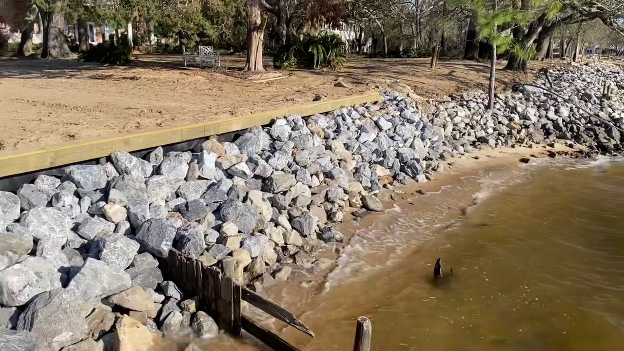
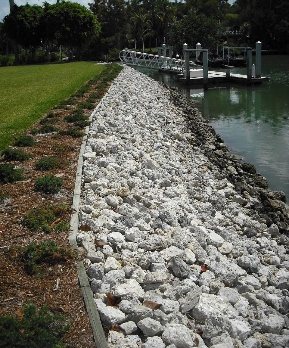
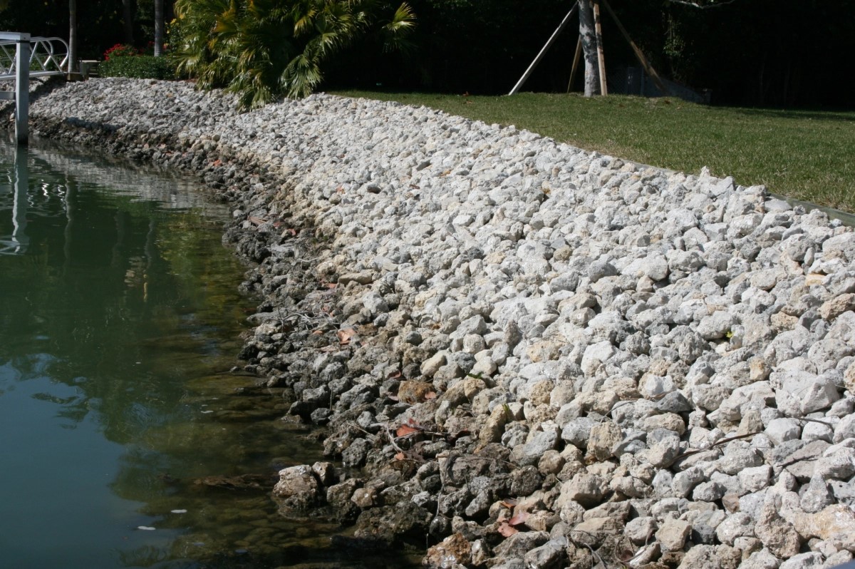
Rip rap installation begins with carefully determining the area to be covered. The chosen stones—rip rap rocks or rip rap stones—are meant to be large enough to resist being carried away by the waves or fast-flowing water. These stones are placed over the soil in the area that you want to protect from erosion. A rip rap driveway or rip rap culvert, for instance, will ensure stormwater runoff does not wash away important soil from these sections. These rock or stone layers, often sourced from reliable suppliers like D&J Contracting near you, provide a level of resilience against natural weather phenomena. For commercial properties with lakes or ponds on-site, pond rip rap proves to be an excellent addition for protecting the body of water’s boundary soil layers from erosion.
Benefits of Rip Rap for Commercial Properties
The buffer zone created by rip rap rock significantly reduces maintenance costs associated with continual soil erosion. Commercial properties, especially those that have invested in landscaping, often utilize landscape rip rap for enhanced appeal and structural integrity against potential water or wind erosion. In addition to improving the physical stability, properties that incorporate this method of erosion control often see an increase in their property value, an aspect that cannot be underestimated for businesses.
Moreover, commercial properties in Marysville are increasingly applying rip rap in creative ways such as rip rap in ditches or even as an alternative for lawn areas in the form of rip rap gravel. And it’s not just the physical benefits. Utilizing rip rap is also an environmentally friendly option – it creates habitats for many types of wildlife, from small critters to birds, and even aquatic life in instances of shoreline or pond riprap. At a time when the push for sustainable practices is at an all-time high, having rip rap on a commercial property sends a positive message to partners and customers about your environmental commitment.
Real-World Applications
Various commercial property types including those with natural water bodies, parking lots, and sizable landscapes have found diverse applications for rip rap. Hotels and resorts have effectively used beach rip rap to control beach erosion and maintain the appealing aesthetics of their beachfront properties. Industrial parks, often with comprehensive drainage systems, utilize rip rap rock in ditches to control the flow of water, reducing the risk of erosion in the surrounding areas. Rip rap rock is also used in driveways in commercial buildings, contributing to the long-lasting and low-maintenance attributes that these properties require. In each of these applications, the implementation of rip rap ends up being a win-win, offering both aesthetic appeal and practical benefits.
D&J Contracting: Expert Rip Rap Service Provider
In Marysville, D&J Contracting specializes in providing top-notch rip rap services. If your commercial property could benefit from the preventative and aesthetic qualities of rip rap, we encourage you to reach out to our team of specialists. With countless successful projects in the area, we have a deep understanding of the best practices and are reliably stocked with rip rap rocks and stones.
Closing Words
In conclusion, the usage of rip rap in commercial properties has proven to be far more than a trend. Given the multitude of benefits including cost-effectiveness, increased durability of the landscape, and the enhancement of environmental sustainability, this practice is here to stay. With professional and proven support from local experts such as D&J Contracting, commercial properties in Marysville can effortlessly incorporate rip rap and enjoy a more attractive, resilient, and valuable environment. As we continue to build on our commercial landscapes, may we remember to protect and enhance what was inherent to it. In that respect, rip rap proves to be quite the ally.
Rip Rap Services Gallery


Call Us Today to receive your Free Quote for
Rip Rap in Marysville
Serving: Marysville, Michigan

About Marysville, Michigan
Marysville traces its history back to 1786 when Antoin Morass built a sawmill at Bunce Creek. Later, in 1817, Zephaniah W. Bunce sailed up the St. Clair River and settled at the place of the mill, naming it Bunce Creek. This would later become the property of the Detroit Edison Marysville Power Plant. He later became postmaster and a member of the Michigan Territorial Council.
Meanwhile, two businessmen, Meldrum & Park, founded a sawmill in 1792 at the location now known as Cuttle Creek. This settlement was located in the southern part of current day Marysville, two streets are named after them.
Also having a street named for him was Colonel Andrew Mack, a native and the 11th mayor of Detroit. He bought Meldrum and Park’s mill and built his home and a general store along the St. Clair River. The small settlement with Mack’s general store and mill was called “Mack’s Place” and was awarded a post office. Mack was a state representative, Colonel in the War of 1812, and a co-founder of the Detroit Free Press. Colonel Mack and his wife, Amelia, are buried on the north bank of Cuttle Creek in the Riverview Golf Course.
Later, Edward P. Vickery settled at the present day foot of Huron Boulevard in Marysville. He named the operation Vickery’s Landing and the settlement surrounding it eventually became known as Vicksburg. In 1854, the Mack’s Place post office was transferred to Vicksburg. However, there was already another Vicksburg, Michigan, so in 1859 the name was changed to Marysville, after Nelson Mill’s wife Mary.
These small settlements were brought together by inventor and engineer, C. Harold Wills. He worked at the Ford Motor Company, and was considered the “right-hand man” of Henry Ford. His contributions to the Ford company included designing Models A through T of the early Ford Motor Company. He was the inventor of many auto improvements including the planetary transmission used in the Models S and T. He was a pioneer in the use of vanadium steel and designed the “Blue Oval” logo, still used on Ford Products today. He resigned in 1919 and moved to Marysville to establish the C. H. Wills & Company on the banks of the St. Clair River. Two years later in 1921, the first Wills Ste. Clair automobile was produced (named for the factory’s location on the St. Clair River). The factory closed in 1926 after 14,000 vehicles were made by the Wills factory.
Wills’ and his partner John Lee provided much of the early infrastructure of Marysville, including electricity, sidewalks, roads, etc. so that Wills is credited with the street design and city planning of Marysville. He nicknamed Marysville the “Dream City”. The main area of the city to be developed before his company folded was the area surrounding Washington Elementary School. The community was deeply affected by the Great Depression, and the vision for the city was never fully realized. Subdivision development in the later half of the 20th century has further offset the strategic plan for the City of Marysville.
Wills did succeed to the extent that the Marysville area is nowadays a vibrant community. Wills’ former factory currently houses the Chrysler Corporation MOPAR parts distribution facility.
Marysville was incorporated as a village in 1919. It became an incorporated city in 1924.
- According to the United States Census Bureau, the city has a total area of 8.30 square miles (21.50 km), of which 7.31 square miles (18.93 km) is land and 0.99 square miles (2.56 km) is water.
- It is considered to be part of the Thumb of Michigan.
- Marysville can also be considered as in the Blue Water Area.
- The city lies on the border between Michigan and Ontario formed by the St. Clair River
- Marysville is neighbored by Port Huron, Michigan to the north, St. Clair, Michigan to the south, Kimball Township, Michigan to the west, and Corunna, Ontario to the east.
| Census | Pop. | Note | %± |
|---|---|---|---|
| 1920 | 941 | — | |
| 1930 | 1,405 | 49.3% | |
| 1940 | 1,777 | 26.5% | |
| 1950 | 2,534 | 42.6% | |
| 1960 | 4,065 | 60.4% | |
| 1970 | 5,610 | 38.0% | |
| 1980 | 7,345 | 30.9% | |
| 1990 | 8,515 | 15.9% | |
| 2000 | 9,684 | 13.7% | |
| 2010 | 9,959 | 2.8% | |
| 2020 | 9,997 | 0.4% | |
| U.S. Decennial Census | |||
As of the census of 2010, there were 9,959 people, 4,160 households, and 2,738 families residing in the city. The population density was 1,362.4 inhabitants per square mile (526.0/km). There were 4,515 housing units at an average density of 617.6 units per square mile (238.5 units/km). The racial makeup of the city was 97.5% White, 0.3% African American, 0.2% Native American, 0.6% Asian, 0.4% from other races, and 0.9% from two or more races. Hispanic or Latino of any race were 1.8% of the population.
There were 4,160 households, of which 29.8% had children under the age of 18 living with them, 53.1% were married couples living together, 9.1% had a female householder with no husband present, 3.6% had a male householder with no wife present, and 34.2% were non-families. 30.3% of all households were made up of individuals, and 14.7% had someone living alone who was 65 years of age or older. The average household size was 2.39 and the average family size was 2.99.
The median age in the city was 42 years. 23.4% of residents were under the age of 18; 7% were between the ages of 18 and 24; 24% were from 25 to 44; 28% were from 45 to 64; and 17.5% were 65 years of age or older. The gender makeup of the city was 48.1% male and 51.9% female.
As of the census of 2000, there were 9,684 people, 4,025 households, and 2,741 families residing in the city. The population density was 1,395.6 inhabitants per square mile (538.8/km). There were 4,180 housing units at an average density of 602.4 units per square mile (232.6 units/km). The racial makeup of the city was 98.18% White, 0.18% African American, 0.30% Native American, 0.43%Asian, 0.01% Pacific Islander, 0.33% from other races, and 0.57% from two or more races. Hispanic or Latino of any race were 1.16% of the population.
There were 4,025 households, out of which 30.8% had children under the age of 18 living with them, 57.4% were married couples living together, 8.0% had a female householder with no husband present, and 31.9% were non-families. 28.5% of all households were made up of individuals, and 14.3% had someone living alone who was 65 years of age or older. The average household size was 2.40 and the average family size was 2.96.
In the city, the population was spread out, with 24.4% under the age of 18, 6.9% from 18 to 24, 28.4% from 25 to 44, 23.3% from 45 to 64, and 17.1% who were 65 years of age or older. The median age was 39 years. For every 100 females, there were 94.0 males. For every 100 females age 18 and over, there were 89.2 males.
The median income for a household in the city was $49,299, and the median income for a family was $60,028. Males had a median income of $47,859 versus $27,321 for females. The per capita income for the city was $23,443. About 3.1% of families and 4.6% of the population were below the poverty line, including 5.1% of those under age 18 and 8.4% of those age 65 or over.
Call Us Today to receive your Free Quote for
Rip Rap in Marysville
Related Services in Marysville, Michigan
We Serve Businesses In The Following Zip Codes:
48007, 48015, 48021, 48026, 48035, 48036, 48038, 48042, 48043, 48044, 48045, 48046, 48047, 48048, 48050, 48051, 48066, 48071, 48080, 48081, 48082, 48083, 48084, 48085, 48088, 48089, 48090, 48091, 48092, 48093, 48098, 48099, 48225, 48230, 48236, 48310, 48311, 48312, 48313, 48314, 48315, 48316, 48317, 48318, 48397