Rip Rap Servicesin Madison Heights MI
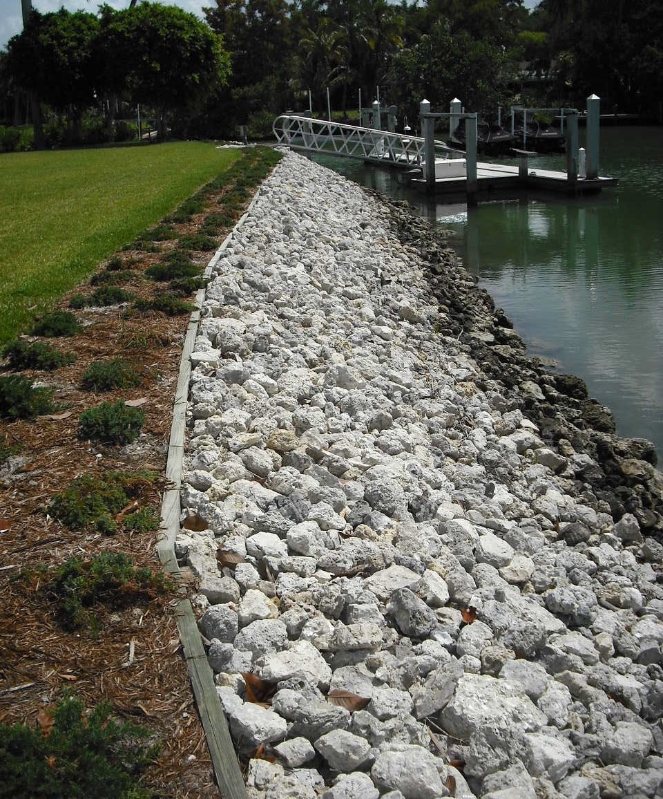
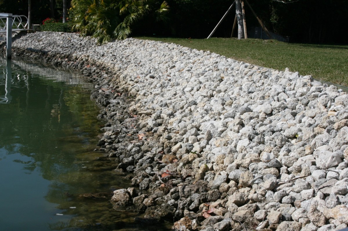
Rip Rap Placement to Protect Your Shoreline from Erosion
We Are Locally Owned & Operated For Over 37 Years
Contact Us Today!
We Serve Businesses In And Around The Following Cities:
About Rip Rap Services
Rip Rap in Madison Heights: Unearthing the Commercial Value
Immersed within the city sprawl of Madison Heights is an architectural strategy focused on landscape preservation, enhancing commercial properties, and bringing a sense of toughness and texture into urban aesthetics. Known as rip rap, this strategy employs the use of rocks and stones to control erosion, fortify structures, beautify landscapes, and enrich the value of commercial real estate developments. Rip rap, often characterized as ‘armoured elegance’, combines construction science, landscape artistry and durability to create long-lasting value and functionality. In Madison Heights, rip rap stone has become a signature technique for landscape architects, favored for its unparalleled resilience and unique visual appeal.
Demystifying Rip Rap
Rip rap, also known as riprap, rubble, shot rock, or rock armour, is typically comprised of a loose, irregularly shaped stone material. This includes rock and gravel, utilized to protect shoreline structures against erosion caused by water or weather elements. Erosion control with rip rap has been widely adopted as it’s both affordable and effective. Applied to commercial properties, rip rap is typically used around pond banks, ditches, culverts and driveways. The strength and versatility of rip rap rock have made it a popular choice for erosion control and landscaping in Madison Heights.
Sculpting a Landscape with Rip Rap
For commercial property owners in Madison Heights, the usage of rip rap stone extends far beyond its functional aspect. The aesthetic appeal of a rip rap ditch or a rip rap driveway has transformed landscaping paradigms, making it a go-to technique for creating visually capturing structures. Landscape rip rap allows businesses to infuse their commercial spaces with an enduring charm that combines raw, natural beauty with sophistication. Therefore, it is not surprising that landscaping companies, such as D&J Contracting, have embraced rip rap as a favored tool for creating eye-catching property designs.
Harnessing the Benefits of Rip Rap for Commercial Properties
The commercial benefits of employing rip rap in Madison Heights are multifaceted. Firstly, it provides unmatched durability and strength, fortifying structures against the impacts of harsh weather elements, a crucial characteristic in regions susceptible to harsh climate conditions. Rip rap erosion control ensures the longevity of structures such as ditches, driveways, and pond banks, reducing the need for costly and regular maintenance.
Secondly, the use of rip rap rock contributes significantly to the aesthetic appeal of commercial properties. Resources like D&J Contracting can skillfully craft landscapes using rip rap, turning ordinary spaces into extraordinary landscapes. The visual appeal of a well-placed rip rap shoreline or a thoughtfully designed rip rap pond can enhance the overall value of a commercial property, setting it apart in the competitive Madison Heights real estate market.
Rip Rap Installation Process
The installation of rip rap involves meticulous planning and preparation. This may require the expertise of seasoned professionals like D&J Contracting to ensure a seamless installation. The process starts with careful site preparation, followed by the sourcing and placement of high-quality riprap material. Rip rap rock must be placed strategically to maximize its erosion control capabilities while ensuring aesthetic appeal. A sloped configuration is often used to maximize the stability and drainage capabilities of the structure. This underlines the importance of entrusting your rip rap project to experienced professionals who can deliver a blend of functionality and design elegance.
Turning to Rip Rap Experts
Whether looking to enhance a pond rip rap, a rip rap culvert, or a rip rap driveway, commercial property owners in Madison Heights are turning to D&J Contracting, recognized for their expertise and vast experience in the field. The company’s reputation for delivering superior rip rap projects stems from its dedication to providing quality service and its deep understanding of the local landscape and climate conditions.
There’s no denying the transformative power of rip rap, especially when it comes to commercial properties. Beyond the practicality of implementing rip rap as a protective strategy for erosion control, this methodology has also transformed landscapes into exquisite outdoor spaces, enhancing visual appeal and adding a special charm to commercial establishments in Madison Heights. Whether you are looking to develop a rip rap landscape or need guidance on enhancing an existing one, there’s no better time than now to see how rip rap could liven up your commercial property.
Rip Rap Services Gallery


Call Us Today to receive your Free Quote for
Rip Rap in Madison Heights
Serving: Madison Heights, Michigan

About Madison Heights, Michigan
Originally part of Royal Oak Township, Madison Heights incorporated as a city by popular vote on January 17, 1955, and chartered on December 6 of that same year, becoming the tenth city government in southern Oakland County. At that time, the 7.2 square miles (18.6 km) city was one of the largest suburban communities in the Metro Detroit area. The first city hall was at 26305 John R Road, the former township offices. On April 5, 1963, a new municipal building was dedicated which is on the present location at 300 West Thirteen Mile Road. The city lies in the Interstate 696 (I-696) and I-75 corridor and is served by two primary school districts, Lamphere and Madison, as well as a full-service municipal government.
According to the United States Census Bureau, the city has a total area of 7.09 square miles (18.36 km), all land.
Although 91% of the buildings in Madison Heights are single-family homes or condominiums (approximately 9,800 residential property owners), 60% of the tax base is fueled by light industrial or commercial property. The city has 15 voting precincts, totaling more than 21,000 registered voters.
Madison Heights shares borders with Troy to the north, Royal Oak to the west, Hazel Park to the south, and Warren to the east. The eastern border of Madison Heights (Dequindre Road) is also the border between Oakland and Macomb counties.
There are more than 112 miles (180 km) of road within Madison Heights, of which the city maintains 105 miles (169 km), 95 miles (153 km) for snow removal, sweeping, and patching. Interstate 75 passes north to south on the west side of the city, and Interstate 696 is the major feature of its southern border. The junction of these two highways is shared with Royal Oak and Hazel Park on the southwest corner of Madison Heights.
| Census | Pop. | Note | %± |
|---|---|---|---|
| 1960 | 33,343 | — | |
| 1970 | 38,599 | 15.8% | |
| 1980 | 35,375 | −8.4% | |
| 1990 | 31,296 | −11.5% | |
| 2000 | 31,101 | −0.6% | |
| 2010 | 29,694 | −4.5% | |
| 2020 | 28,468 | −4.1% | |
| U.S. Decennial Census | |||
As of the 2020 United States census of 2020, there were 28,468 people and 13,487 households in the city. The population per square mile is 4,017.5.
The racial makeup of the city was 80.4% White, 7.8% African American, 0.2% Native American, 7.2% Asian, 0.1% Pacific Islander, 3.6% from two or more races. Hispanic or Latino residents of any race were 2.0% of the population.
There were 13,487 households, of which 14.7% spoke a language other than English at home. People under 65 years of age with a disability accounted for 11.1% of the city’s population, and 11.7% of the city’s population was living below the federal poverty line. Households without a broadband internet subscriptions made up 11.9% of the community.
16% of residents were under the age of 18; and 16.3% were 65 years of age or older. The gender makeup of the city was 49.4% male and 50.6% female.
As of the census of 2010, there were 29,694 people, 12,712 households, and 7,543 families residing in the city. The population density was 4,188.2 inhabitants per square mile (1,617.1/km). There were 13,685 housing units at an average density of 1,930.2 per square mile (745.3/km). The racial makeup of the city was 83.9% White, 6.4% African American, 0.5% Native American, 5.8% Asian, 0.1% Pacific Islander, 0.7% from other races, and 2.7% from two or more races. Hispanic or Latino residents of any race were 2.5% of the population.
There were 12,712 households, of which 27.5% had children under the age of 18 living with them, 41.0% were married couples living together, 12.9% had a female householder with no husband present, 5.4% had a male householder with no wife present, and 40.7% were non-families. 34.1% of all households were made up of individuals, and 11.8% had someone living alone who was 65 years of age or older. The average household size was 2.32 and the average family size was 3.02.
The median age in the city was 38.3 years. 20.4% of residents were under the age of 18; 8.7% were between the ages of 18 and 24; 30.4% were from 25 to 44; 26.6% were from 45 to 64; and 13.9% were 65 years of age or older. The gender makeup of the city was 49.1% male and 50.9% female.
As of the 2000 United States census, there were 31,101 people, 13,299 households, and 8,005 families residing in the city. The population density was 4,341.3 inhabitants per square mile (1,676.2/km). There were 13,623 housing units at an average density of 1,901.6 per square mile (734.2/km). The city’s racial makeup was 89.60% White, 1.82% African American, 0.44% Native American, 4.97% Asian, 0.03% Pacific Islander, 0.46% from other races, and 2.68% from two or more races. Hispanic or Latino residents of any race were 1.61% of the population.
There were 13,299 households, of which 26.9% had children under the age of 18 living with them, 45.2% were married couples living together, 10.5% had a female householder with no husband present, and 39.8% were non-families. 33.8% of all households were made up of individuals, and 12.3% had someone living alone who was 65 years of age or older. The average household size was 2.33 and the average family size was 3.02.
In the city, 22.1% of the population was under the age of 18, 8.1% was from 18 to 24, 35.4% from 25 to 44, 20.2% from 45 to 64, and 14.2% was 65 years of age or older. The median age was 36 years. For every 100 females, there were 95.8 males. For every 100 females age 18 and over, there were 92.9 males.
The city’s median household income was $42,326, and the median family income was $51,364. Males had a median income of $41,478 versus $29,345 for females. The city’s per capita income was $21,429. About 7.0% of families and 8.9% of the population were below the poverty line, including 10.8% of those under age 18 and 13.0% of those age 65 or over.
In 2008, 1.9% of the Madison Heights population were of Vietnamese descent. 168 Asian Mart, a 38,000-square-foot (3,500 m) supermarket, is the largest Asian supermarket in southeast Michigan, and one of the largest in the state. The Chinese Cultural Center is in Madison Heights.
The mayor of Madison Heights is Roslyn Grafstein, who was appointed as Mayor in August 2020 to fill a vacant seat.
Madison District Public Schools and Lamphere Public Schools have public schools serving Madison Heights.
Bishop Foley Catholic High School is a private school.
Four Corners Montessori Academy is a public charter school.
Call Us Today to receive your Free Quote for
Rip Rap in Madison Heights
Related Services in Madison Heights, Michigan
We Serve Businesses In The Following Zip Codes:
48007, 48015, 48021, 48026, 48035, 48036, 48038, 48042, 48043, 48044, 48045, 48046, 48047, 48048, 48050, 48051, 48066, 48071, 48080, 48081, 48082, 48083, 48084, 48085, 48088, 48089, 48090, 48091, 48092, 48093, 48098, 48099, 48225, 48230, 48236, 48310, 48311, 48312, 48313, 48314, 48315, 48316, 48317, 48318, 48397