Rip Rap Servicesin Clay Township MI
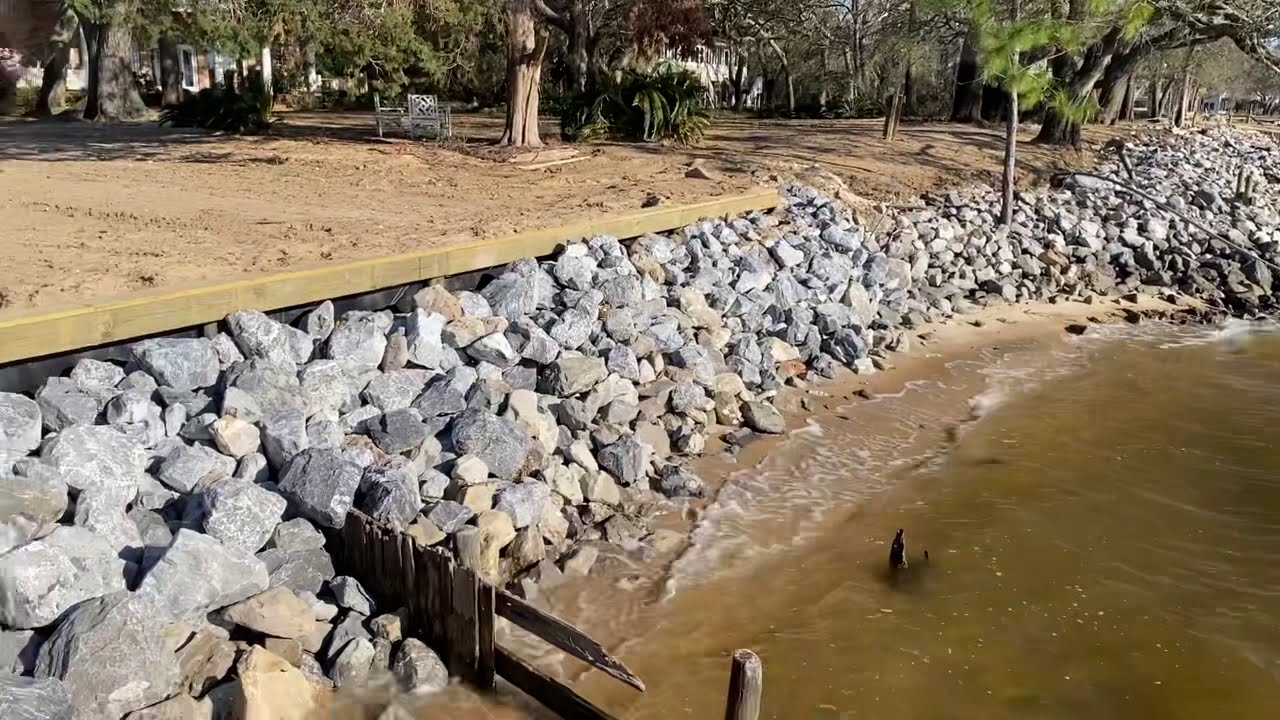
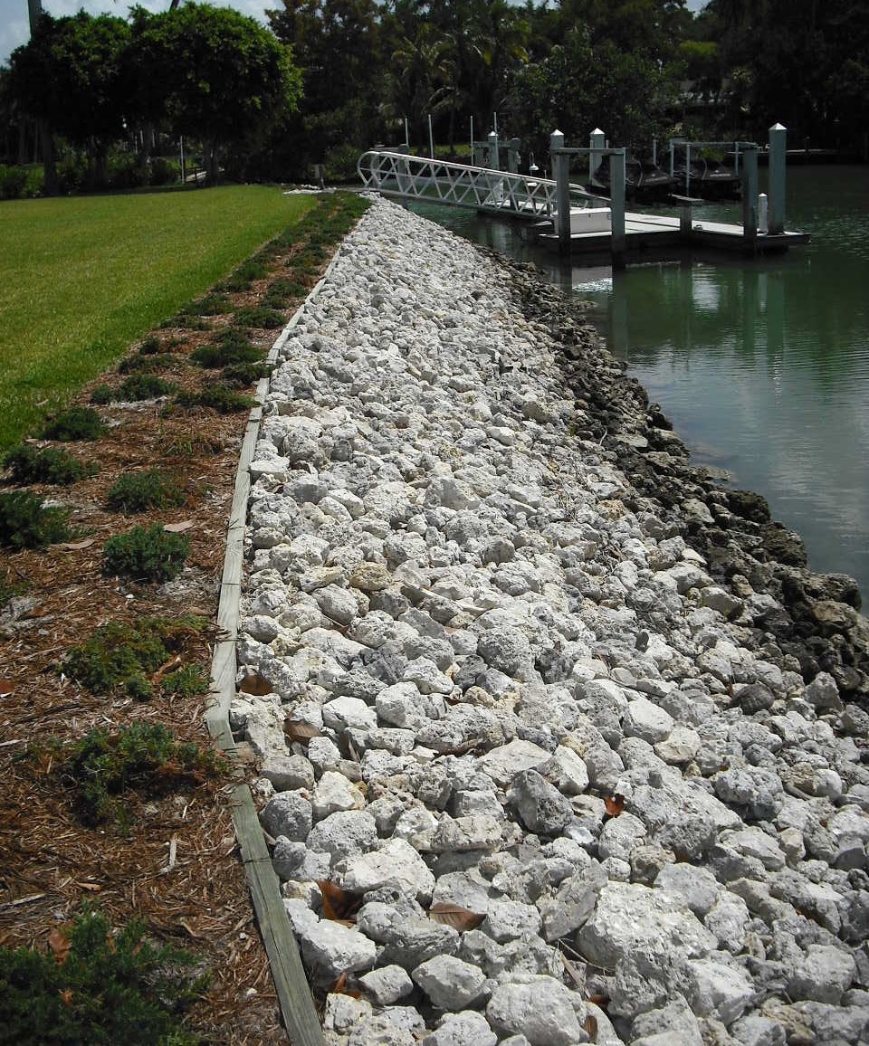
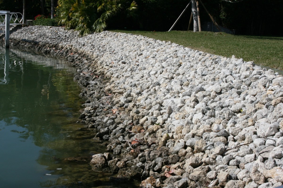
Rip Rap Placement to Protect Your Shoreline from Erosion
We Are Locally Owned & Operated For Over 37 Years
Contact Us Today!
We Serve Businesses In And Around The Following Cities:
About Rip Rap Services
Rip Rap in Commercial Properties: A Comprehensive Guide for Clay Township
With increasing bouts of extreme weather events, climate change presents an urgent challenge to property owners, planners, and environmentalists worsened. As part of an armory of solutions, we find Rip Rap taking center stage, especially in the city of Clay Township, where commercial properties have begun seeing its strategic relevance. This comprehensive guide focuses on elucidating the process, benefits, and real-world applications of Rip Rap to provide an insightful perspective on this fascinating subject.
Understanding Rip Rap and its Importance
If you’re unfamiliar with Rip Rap, you are not alone. Also known as riprap rock or rip rap stone, it’s a term used to describe large, broken stones placed over soil to protect it from erosion, particularly around structures and bodies of water. A rip rap ditch or a rip rap driveway, for instance, can be an excellent erosion control strategy. As such, rip rap rock has become a popular choice for a variety of commercial properties within Clay Township.
Process of Installing Rip Rap
The process of installing Rip Rap starts by creating a solid foundation, which may involve excavating the surrounding area and laying down a fabric barrier to control weeds. The riprap rock is then layered over this fabric, typically starting from the bottom and working upward to ensure maximum stability. Special attention is often given to the shape and size of the rip rap rock used, making it a custom-fit erosion control measure for each property. For professional and accurate installation, businesses and property owners tend to consult local contractors such as D&J Contracting, known for their suitable workmanship and superior quality rip rap stone.
Benefits of Using Rip Rap
The real-world benefits of using rip rap stone are manifold. First, it serves as a practical method for erosion control rip rap rock. It is particularly effective around bodies of water, where erosion due to waves can become a significant issue, making rip rap pond or lake rip rap applications incredibly beneficial. Moreover, a rip rap shoreline can help maintain the integrity and stability of the adjacent structures. Another not-so-obvious advantage of using rip rap is its aesthetic value that can significantly enhance a property’s overall visual appeal, proving its place in landscape rip rap and landscape riprap applications.
Commercial properties can leverage the use of rip rap for erosion control while also integrating it with the landscape design. A rip rap rock driveway, for instance, not only controls erosion but also lifts the property’s aesthetic appeal. Similarly, a pond rip rap can enhance the riparian environment while protecting the pond’s embankments from erosion. The scope for creativity enhances when businesses like D&J Contracting integrate rip rap applications aesthetically and functionally.
Real-World Applications of Rip Rap
The use of Rip Rap in Clay Township’s commercial properties extends from simple drainage control applications to complex landscaping designs cleverly structured around enhancing erosion control. For instance, a rip rap gravel pathway can significantly reduce maintenance costs while offering excellent control against water and wind erosion. A well-designed rip rap culvert can control water flow and prevent washouts that could potentially harm the structure or the surrounding environment.
Moreover, beach rip rap applications have gained popularity, mainly due to their dual functionality: reducing beach erosion while creating visually appealing landscapes. The skilled workmanship offered by D&J Contracting and their team allows gained trust and properties across Clay Township, from local parks to business complexes, to show rip rap’s versatility and value.
The blend of practicality, functionality, and visual appeal makes Rip Rap an increasingly popular choice among commercial property owners in Clay Township. More so when this functionality pairs with the trusted services of D&J Contracting that ensures quality rip rap rock and professional installation. This guide aims to provide valuable insights into Rip Rap and its applications while sparking interest and inspiring ideas for how it might enhance and protect your properties. As the old adage goes, “Prevention is better than cure.” With Rip Rap, not only can we prevent and control erosion but also enhance the visual appeal of our properties – a win-win solution.
Rip Rap Services Gallery


Call Us Today to receive your Free Quote for
Rip Rap in Clay Township
Serving: Clay Township, Michigan

About Clay Township, Michigan
The area was first settled by John Martin in 1805, and the area was originally referred to as Pointe du Chene (Oak Point). In 1826, the area was organized as Plainfield Township, which was named by early settler John K. Smith after his hometown of Plainfield, Vermont. A post office named Plainfield began operating here on April 5, 1826 with Smith serving as the first postmaster. In 1828, the township was reorganized and renamed after attorney and statesman Henry Clay, and the post office was later renamed Clay on December 23, 1835; Smith continued serving as postmaster. The post office was renamed Algonac on August 17, 1843. Algonac incorporated as a village within Clay Township in 1867. The village gained autonomy from the township when it incorporated as a city in 1967.
- Colony Tower Complex
- Harsen House
- LeRoy Smith House
- North Channel Shooting Club
- St. Clair River Informational Designation
- Stewart Farm / Memoir of Aura Stewart
- St. Clair Flats Front and Rear Range Light
According to the U.S. Census Bureau, the township has a total area of 82.47 square miles (213.60 km), of which 35.32 square miles (91.48 km) is land and 47.15 square miles (122.12 km) (57.17%) is water.
The township contains a large portion of water that includes areas along the St. Clair River mouth in the northern Anchor Bay area of Lake St. Clair, which contains numerous channels and canals. Directly across the river is the Walpole Island First Nation in Ontario, which is accessible via the Walpole–Algonac Ferry in downtown Algonac.
The St. Clair Flats State Wildlife Area and the majority of the St. John’s Marsh State Wildlife Area are located within Clay Township. Most of Algonac State Park is located within Clay Township with a small portion extending north into Cottrellville Township.
- Bedore is an unincorporated community located along the southern coast of Harsens Island at 42°33′28″N 82°36′47″W / 42.5578126°N 82.6129630°W.
- Clays Landing is an unincorporated community located at the southern terminus of M-154 on Harsens Island at 42°33′06″N 82°36′16″W / 42.5517016°N 82.6043512°W.
- Forster is an unincorporated community located just west of Bedore at 42°33′40″N 82°37′06″W / 42.5611459°N 82.6182410°W.
- Grand Pointe is an unincorporated community located in the northeastern area of Harsens Island at 42°35′58″N 82°32′43″W / 42.5994788°N 82.5451844°W. The affluent community was settled as early as 1888 by the Grand Pointe Improvement Company, and a post office operated briefly from October 16, 1889 until January 5, 1892.
- Harsens Island is the name of the post office that serves the island and several surrounding islands. Harsens Island was first settled as early as 1779 by James Harsen, who was the area’s first white settler. By 1783, Harsen had purchased the entire island from its native Indian population. As late as 1809, the island was also known as James (also Jacob or Jacobus) Island. The post office began operating under the name Sans Souci on April 24, 1900 and was renamed Harsens Island on December 31, 1960. The post office uses the 48028 ZIP Code.
- Maple Leaf is an unincorporated community located on Harsens Island just southwest of the community of Sans Souci at 42°34′41″N 82°34′11″W / 42.5780902°N 82.5696288°W.
- Miller is an unincorporated community located near the southernmost end of Harsens Island at the end of public road access at 42°32′57″N 82°39′32″W / 42.5492017°N 82.6587976°W.
- Muirs is an unincorporated community located along M-154 on Harsens Island at 42°33′23″N 82°35′14″W / 42.5564238°N 82.5871285°W.
- Pearl Beach is an unincorporated community and census-designated place (CDP) located along the southern end of the mainland at 42°37′36″N 82°35′52″W / 42.6267006°N 82.5976876°W.
- Perch Point is an unincorporated community located along M-29 in the northwestern portion of the township along the border with Ira Township at 42°39′54″N 82°37′13″W / 42.6650333°N 82.6201900°W.
- Pointe aux Tremble is an unincorporated community located along M-29 within the Pearl Beach CDP at 42°37′17″N 82°34′16″W / 42.6214230°N 82.5710196°W. The community was settled in 1904 as a station along the railway about 3.0 miles (4.8 km) west of Algonac.
- Riverside is an unincorporated community located in the southern portion of Harsens Island at 42°33′32″N 82°37′49″W / 42.5589237°N 82.6301859°W.
- Roberts Landing is an unincorporated community located along M-29 near Algonac State Park along the border with Cottrellville Township at 42°39′35″N 82°30′57″W / 42.6597561°N 82.5157415°W. The community was named after its first settler, who arrived here in 1830. The Roberts family settled the area as a popular fishing and hunting destination. A post office operated here from April 29, 1869 until December 15, 1895.
- Sans Souci is an unincorporated community located on Harsens Island at 42°34′52″N 82°33′44″W / 42.5811490°N 82.5621580°W.
As of the census of 2000, there were 9,822 people, 3,934 households, and 2,844 families residing in the township. The population density was 277.0 inhabitants per square mile (107.0/km). There were 5,325 housing units at an average density of 150.2 per square mile (58.0/km). The racial makeup of the township was 97.92% White, 0.20% African American, 0.68% Native American, 0.11% Asian, 0.21% from other races, and 0.87% from two or more races. Hispanic or Latino of any race were 0.85% of the population.
There were 3,934 households, out of which 27.9% had children under the age of 18 living with them, 61.3% were married couples living together, 7.0% had a female householder with no husband present, and 27.7% were non-families. 22.9% of all households were made up of individuals, and 9.2% had someone living alone who was 65 years of age or older. The average household size was 2.50 and the average family size was 2.94.
In the township the population was spread out, with 22.6% under the age of 18, 6.5% from 18 to 24, 28.2% from 25 to 44, 28.8% from 45 to 64, and 13.9% who were 65 years of age or older. The median age was 41 years. For every 100 females, there were 103.6 males. For every 100 females age 18 and over, there were 103.2 males.
The median income for a household in the township was $55,059, and the median income for a family was $63,182. Males had a median income of $48,053 versus $31,923 for females. The per capita income for the township was $27,169. About 2.3% of families and 4.7% of the population were below the poverty line, including 6.7% of those under age 18 and 3.6% of those age 65 or over.
Call Us Today to receive your Free Quote for
Rip Rap in Clay Township
Related Services in Clay Township, Michigan
We Serve Businesses In The Following Zip Codes:
48007, 48015, 48021, 48026, 48035, 48036, 48038, 48042, 48043, 48044, 48045, 48046, 48047, 48048, 48050, 48051, 48066, 48071, 48080, 48081, 48082, 48083, 48084, 48085, 48088, 48089, 48090, 48091, 48092, 48093, 48098, 48099, 48225, 48230, 48236, 48310, 48311, 48312, 48313, 48314, 48315, 48316, 48317, 48318, 48397