Rip Rap Servicesin New Baltimore MI
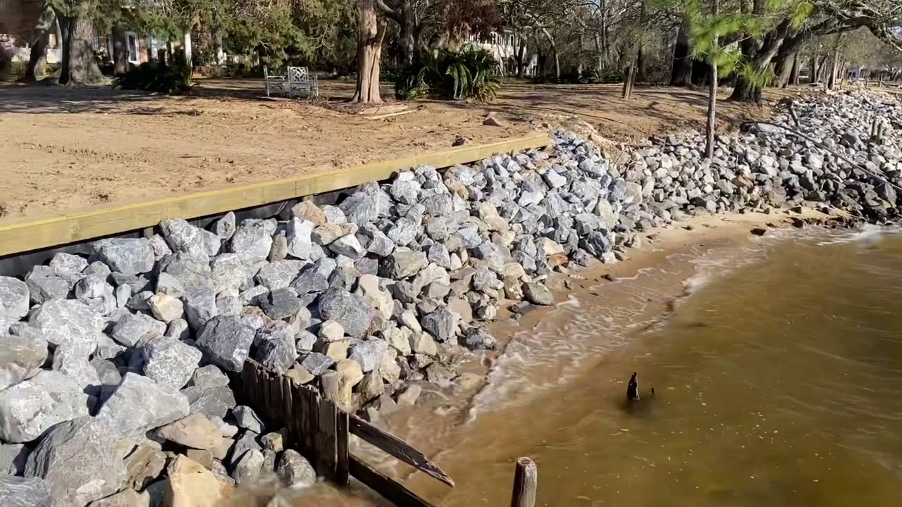
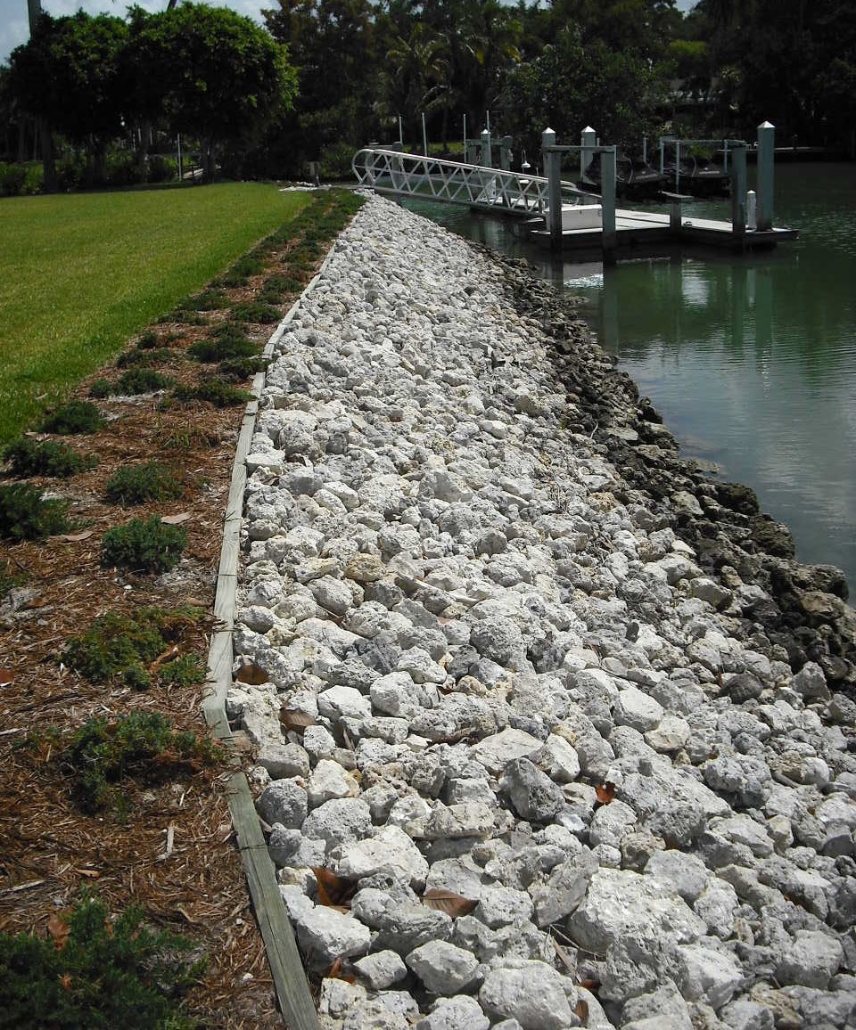
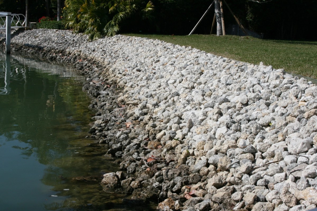
Rip Rap Placement to Protect Your Shoreline from Erosion
We Are Locally Owned & Operated For Over 37 Years
Contact Us Today!
We Serve Businesses In And Around The Following Cities:
About Rip Rap Services
Introduction
Centuries of continuous industrial and urban development have borne an immense need for reliable, robust erosion control measures for commercial properties, necessitating a comprehensive understanding of practical solutions such as rip rap. Its popularity and utility, especially in commercial properties in the city of New Baltimore, is greatly attributed to a host of benefits that it provides. Thus, this article takes an in-depth look into the world of Rip Rap, focusing on its process, real-world applications, and advantages it affords. Pertinently interwoven with real-world contexts are insights into the rip rap rock and stone rip rap variants and their relevance in the context of erosion control and landscaping.
Understanding Rip Rap and Its process
Essentially, rip rap is a human-made rock or other highly durable material layer typically used along shorelines, in ditches, ponds, and driveways, among other areas. It serves to reduce the damaging effects of water, controlling erosion and sedimentation. It often comprises riprap rock, rip rap stone, or other sturdy materials like concrete. The rip rap gravel is meticulously placed to ensure the underlayer soil is protected, therefore controlling erosion. This specification, coupled with the availability of rip rap stone near New Baltimore, gives a unique advantage to commercial properties in these areas.
Practical Rip Rap Applications in New Baltimore
New Baltimore presents a unique landscape that works very well with riprap application. From landscape rip rap hugging shorelines of the cities’ numerous water bodies to rip rap ditch defenses in commercial properties, the relevance is genuinely wide-ranged. A brilliant illustration of this finds home in the rip rap driveways, which have become quite popular for commercial properties within the city. With a reliable partner like D&J Contracting, these driveways, often paved with riprap rock, give an aesthetic appeal while maintaining strategic ground reinforcement against erosion.
Erosion Control using Rip Rap Rock
Erosion control using rip rap, specifically through rip rap rock for commercial properties is pivotal. This approach enhances landscape stability by creating robust barriers against erosion-triggering elements. The rip rap rock, commonly available near me, has been employed in pond rip rap mechanisms in various commercial property ponds across the city. This use of rip rap near me keeps the ponds’ banks intact, considerably reducing erosion while adding a touch of nature’s aesthetic. Lake rip rap defenses and beach rip rap shields are additional real-world cases. These applications contribute positively to the environmental conservation stride, aligning commercial enterprises with global calls for sustainable environmental interactions.
The Benefits of Rip Rap
Applying rip rap, either as rip rap rock or stone rip rap, comes packed with advantages. Firstly, it is durable, and it can handle harsh weather and the continuous pounding of water currents. Secondly, it reduces maintenance costs by lasting many years without needing replacement. Another formidable advantage surfaces from its water drainage capabilities, making rip rap rock or rip rap stone ideal for commercial landscaping. This use eliminates potential structural damage risks, securing property owners’ investments.
Utilizing D&J Contracting for Rip Rap Services
Undoubtedly, partnering with trusted rip rap service providers like D&J Contracting is crucial. They offer unrivaled rip rap installation near New Baltimore, ensuring rip rap is meticulously laid out for maximum benefits. Their decades of experience in offering these services give them an upper hand in delivering a blend of aesthetic appeal and erosion control functions, whether you are seeking rip rap for a ditch or driveway, rip rap shoreline reinforcements, or even pond rip rap defenses.
As we explore the applicability and benefits of rip rap in commercial properties in New Baltimore, D&J Contracting’s prowess in this area cannot be overlooked. They understand the landscape, the people, and the uniqueness of rip rap rock and stone applications within the city. Their services are timely, professional, and ultimately beneficial to property owners.
The adoption of rip rap in New Baltimore commercial properties and the commendable services that D&J Contracting offers provide an excellent combination. As businesses seek to enhance their outdoor spaces while controlling erosion, the mention of rip rap near me is indispensable. With the many variants such as rip rap rock, rip rap stone, and even pond rip rap, the practicality of these services is broad and all-inclusive.
In conclusion, as commercial property owners continue to grapple with the challenge of erosion, rip rap presents a durable, reliable, and effective solution. Not only does it add to the aesthetic appeal of properties, but it also saves on maintenance costs and contributes positively to environmental conservation. Thus, investing in rip rap services offered by a competent service provider such as D & J Contracting would be a wise, long-term decision that guarantees a return on investment.
Rip Rap Services Gallery


Call Us Today to receive your Free Quote for
Rip Rap in New Baltimore
Serving: New Baltimore, Michigan

About New Baltimore, Michigan
New Baltimore incorporated as a village in 1867 and as a city in 1931. Previously, it was split between Macomb and St. Clair counties; however, in the 1970s, the city was able to petition to adjust the county boundaries such that it would align with the city’s eastern border. This placed New Baltimore completely in Macomb County, where it remains to this day. The town sits on the waterfront along Lake St. Clair’s Anchor Bay, and offers a public park, beach, and downtown-shopping district.
Prior to the arrival of European settlers, indigenous tribes are known to have inhabited much of New Baltimore’s shoreline for thousands of years, and in the 1800s the land was recorded to have many ancient burial mounds and man made earth-works. W.B Hinsdale excavated multiple sites in New Baltimore, and recorded his countless findings in his novels in the early 20th century. Most of these locations have long been destroyed by treasure hunters and developed over, with an unfortunate though seemingly familiar lack of regard to the public’s knowledge of the city’s vast history with indigenous tribes.
German explorer Pierre Yax (b.1763) in Grosse Pointe, New France (now Michigan) was the first recorded non-Native American in the New Baltimore area. Pierre Yax was a son of Johan Michael Jacks, the first German in what would eventually become the state of Michigan. Pierre Yax arrived in New Baltimore in 1796 and subsequently obtained a land grant signed by President John Quincy Adams on July 23, 1826. The land grant tracked back to a land patent Yax had in 1812, when Michigan was still part of the Michigan Territory.
Later, other French settlers came to this area and took residence along the waterfront and rivers. They developed farms that had narrow frontage of 400 of 900 feet and extended inland from the water. Generally, the depth of the parcel was determined by how far a man could plow or cultivate in a day.
The first evidence of a settled community came in 1845, when a Mount Clemens businessman, Alfred Ashley, platted 60 acres (24 ha) of land lying on both sides of Washington Street. This would become known as the village of Ashley. On September 20, 1851, a post office called Ashleyville was established with Ashley as postmaster. Ashley also opened businesses in lumbering, shipping, and real estate. The original village of Ashley occupied what is now the center part of downtown New Baltimore, extending northwest along Clay, Base and Maria Streets from Anchor Bay. The land was subdivided in the typical gridiron fashion used in most American communities at that time. Over the years, irregularities developed in the gridiron subdivision pattern because of the lack of local controls, conflicts with French claims, and changing land uses, particularly along the waterfront area. This created problems in both subdivision patterns in general and waterfront use in particular that remain today. This original settlement bore Ashley’s name until 1867, when the village name was changed to New Baltimore.
Throughout its history, New Baltimore has been linked to the regional economy by virtue of the city’s access to the waterfront and the region’s transportation network. In its early years, New Baltimore took advantage of its waterfront location to operate port facilities exporting agriculture and manufacturing products to other communities. The area was known for the manufacturing of barrels, brooms, bricks, coffins, corsets, and creamery products. Lumber products and building materials were shipped by boat from the local mills. Development was heavily oriented to the waterfront, where shipping piers extended a hundred or more feet into the lake.
As automobile transportation increased in importance and travel patterns changed, so did the development of the city. Goods were no longer shipped by water and the waterfront slowly changed. Between 1860 and 1880, New Baltimore changed from a strong manufacturing and exporting community to a thriving community in Macomb County with many resort activities and well-known commercial establishments. The community was a popular getaway spot for Metro Detroiters and boasted an opera house, hotels, salt baths (which nearby city of Mount Clemens was famous for in the late 19th and early 20th centuries), summer and winter recreational activities, saloons, a brewery and numerous resort and commercial establishments. The city was in the path of a steam locomotive line that ran between Detroit and Port Huron in the late 19th century. As technology changed, the city constructed an electricity plant to accommodate inter-urban passenger trains, which lasted until the mid-1920s. Today, access to the city is provided via Interstate 94. The historic New Baltimore water tower was demolished in the summer of 2015 and raised in the park to take its place was the State’s tallest flag. The flagpole stands at 160 feet tall on the shores of Anchor Bay at Walter and Mary Burke Park. The New Baltimore Lions Club raised more than $100,000 to have the flagpole installed with the intention of creating a landmark for boaters after the city’s historic water tower was demolished. A dedication ceremony took place in October 2016.
New Baltimore is in eastern Macomb County, with its eastern border following the St. Clair County line. It is on the northern shore of Anchor Bay, the northernmost part of Lake St. Clair. Highway M-29 passes through the city as Main Street, leading east 14 miles (23 km) to Algonac on the St. Clair River and west 4 miles (6 km) to Interstate 94 in Chesterfield Township. New Baltimore is 10 miles (16 km) northeast of Mount Clemens, the Macomb county seat.
According to the United States Census Bureau, the city has a total area of 6.73 square miles (17.43 km), of which 4.60 square miles (11.91 km) are land and 2.12 square miles (5.49 km), or 31.6%, are water.
| Census | Pop. | Note | %± |
|---|---|---|---|
| 1880 | 1,024 | — | |
| 1890 | 865 | −15.5% | |
| 1900 | 922 | 6.6% | |
| 1910 | 920 | −0.2% | |
| 1920 | 974 | 5.9% | |
| 1930 | 1,148 | 17.9% | |
| 1940 | 1,434 | 24.9% | |
| 1950 | 2,043 | 42.5% | |
| 1960 | 3,159 | 54.6% | |
| 1970 | 4,132 | 30.8% | |
| 1980 | 5,439 | 31.6% | |
| 1990 | 5,798 | 6.6% | |
| 2000 | 7,405 | 27.7% | |
| 2010 | 12,084 | 63.2% | |
| 2020 | 12,117 | 0.3% | |
| U.S. Decennial Census | |||
As of the census of 2010, there were 12,084 people, 4,434 households, and 3,187 families living in the city. The population density was 2,621.3 inhabitants per square mile (1,012.1/km). There were 4,740 housing units at an average density of 1,028.2 per square mile (397.0/km). The racial makeup of the city was 94.4% White, 2.7% African American, 0.4% Native American, 0.9% Asian, 0.2% from other races, and 1.4% from two or more races. Hispanic or Latino of any race were 1.8% of the population.
There were 4,434 households, of which 41.3% had children under the age of 18 living with them, 60.0% were married couples living together, 8.2% had a female householder with no husband present, 3.6% had a male householder with no wife present, and 28.1% were non-families. 23.3% of all households were made up of individuals, and 9.1% had someone living alone who was 65 years of age or older. The average household size was 2.72 and the average family size was 3.25.
The median age in the city was 37.1 years. 28.8% of residents were under the age of 18; 6.6% were between the ages of 18 and 24; 29.6% were from 25 to 44; 25.1% were from 45 to 64; and 9.8% were 65 years of age or older. The gender makeup of the city was 48.9% male and 51.1% female.
As of the census of 2000, there were 7,405 people, 2,942 households, and 1,994 families living in the city. The population density was 1,604.5 inhabitants per square mile (619.5/km). There were 3,218 housing units at an average density of 697.3 per square mile (269.2/km). The racial makeup of the city was 96.89% White, 0.53% African American, 0.36% Native American, 0.47% Asian, 0.04% Pacific Islander, 0.46% from other races, and 1.27% from two or more races. Hispanic or Latino of any race were 1.34% of the population.
There were 2,942 households, out of which 33.1% had children under the age of 18 living with them, 56.3% were married couples living together, 8.2% had a female householder with no husband present, and 32.2% were non-families. 27.4% of all households were made up of individuals, and 10.4% had someone living alone who was 65 years of age or older. The average household size was 2.48 and the average family size was 3.05.
In the city, the population was spread out, with 25.4% under the age of 18, 6.8% from 18 to 24, 34.3% from 25 to 44, 23.7% from 45 to 64, and 9.7% who were 65 years of age or older. The median age was 36 years. For every 100 females, there were 94.6 males. For every 100 females age 18 and over, there were 92.7 males.
The median income for a household in the city was $60,699, and the median income for a family was $72,046. Males had a median income of $49,648 versus $33,083 for females. The per capita income for the city was $26,921. About 1.0% of families and 3.5% of the population were below the poverty line, including 1.3% of those under age 18 and 8.0% of those age 65 or over.
New Baltimore is a home-rule city with an elected mayor and six at-large council members. Since 2022, Tom Semaan has served as mayor.
The city of New Baltimore is within the boundaries of the Anchor Bay School District, and hosts Lighthouse Elementary, Ashley Elementary, Anchor Bay Middle School North, and Anchor Bay’s Aquatic Center.
Call Us Today to receive your Free Quote for
Rip Rap in New Baltimore
Related Services in New Baltimore, Michigan
We Serve Businesses In The Following Zip Codes:
48007, 48015, 48021, 48026, 48035, 48036, 48038, 48042, 48043, 48044, 48045, 48046, 48047, 48048, 48050, 48051, 48066, 48071, 48080, 48081, 48082, 48083, 48084, 48085, 48088, 48089, 48090, 48091, 48092, 48093, 48098, 48099, 48225, 48230, 48236, 48310, 48311, 48312, 48313, 48314, 48315, 48316, 48317, 48318, 48397