Asphalt vs Concrete Sterling Heights Michigan
We Are Locally Owned
& Operated For 36 Years
About Asphalt vs Concrete
Choosing the Right Driveway Surface: Asphalt vs Concrete
Are you planning a property improvement or a construction project soon? One critical decision involves choosing the right surface for your driveway. ‘Asphalt vs Concrete’ is a battle that has been ongoing for years, an evergreen debate amongst homeowners and contractors alike. Whether you’re considering not just the aesthetics, but the ‘driveway paving vs concrete’, ‘asphalt driveway cost vs concrete’, and even ‘concrete vs pavement driveway’, every aspect demands detailed scrutiny. This complete guide focuses on exploring the pros and cons of asphalt and concrete, providing a comprehensive comparison to help you make an informed decision.
Initial Investment: Asphalt Driveway Cost vs Concrete
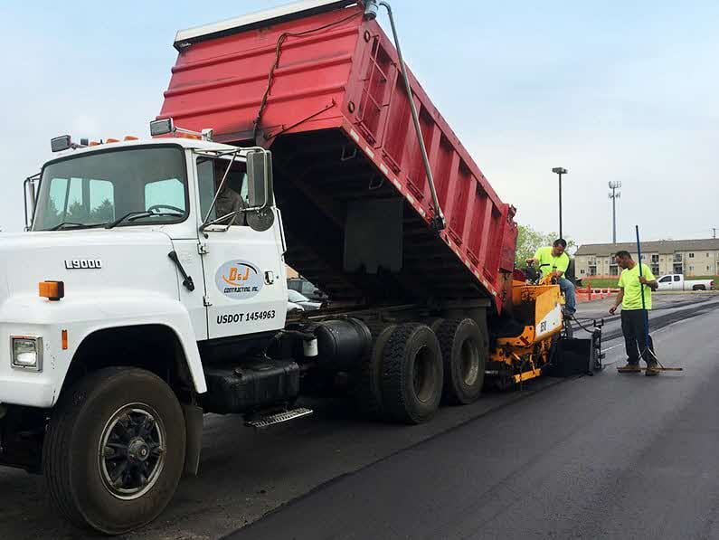
One of the first factors that property owners consider is the initial cost. Generally, asphalt comes out on top in terms of the immediate ‘driveway concrete vs pavers cost’. It is usually less expensive to install, making it a popular choice for those working with tight budgets.
However, when examining the ‘blacktop vs concrete driveway cost’, and specifically for larger, commercial properties, it becomes a bit more complex. Here, long-term investment aspects such as maintenance, durability and lifespan need to be considered alongside the initial cost.
Long-term Maintenance: Black Top Driveway vs Concrete
Costing isn’t just about the upfront expenditure; it also involves the maintenance cost over the years. Here, the ‘cost of blacktop vs concrete’ sees a switch in favor. Although asphalt is initially cost-effective, it requires consistent maintenance to remain in optimum condition. Regular sealing and more frequent repairs increase the long-term ‘cost of asphalt vs concrete’.
Conversely, concrete driveways require less maintenance, saving you time and money in the long run. However, they aren’t immune to needing occasional cleaning and resealing every few years to maintain their appearance and longevity. In the long-term maintenance aspect, concrete tends to outshine asphalt.
Weather Factors and Durability: Concrete vs Pavement Driveway
When pitting ‘concrete vs pavement driveway’, environmental factors come into play. Depending on your geographic location, the fluctuating weather conditions could greatly influence your choice.
Asphalt tends to fare much better in colder climates. It is less likely to crack due to freezing and thawing cycles, as it flexes with temperature changes unlike concrete, which can crack under extreme cold.
However, in sun-soaked, hotter climates, concrete proves more durable. Asphalt can become relatively soft in high heat, making it more vulnerable to scratches and marks from heavy traffic or sharp objects. Concrete, on the other hand, does not degrade or soften in the heat.
Customization and Appeal: Driveway Paving vs Concrete
Your property’s curb appeal is significantly influenced by your driveway surface. When comparing the aesthetics in the ‘driveway paving vs concrete’ debate, concrete ultimately offers greater flexibility. It can be stamped, colored, or have intricate patterns etched into it for a more elegant look. Meanwhile, asphalt mainly offers a basic, uniform black ‘black top driveway vs concrete’ look.
Comparing Lifespan: ‘Asphalt vs Paver Driveway’
In the ‘asphalt vs paver driveway’ scenario, lifespan comparison is a significant factor. Typically, a well-maintained concrete driveway can last up to 30-40 years, while an asphalt driveway may last 20 years with good care. This disparity can tip the scale in favor of concrete for many property owners concerned with longevity.
Conclusion
Both asphalt and concrete driveways have unique advantages and possible drawbacks. Your choice between ‘asphalt vs concrete’ will largely depend on your budget, aesthetic preferences, local climate, and long-term property goals. This guide aims to provide you with the key considerations to keep in mind when deciding the best fitting driveway surface for your commercial property.
Every building project is unique and calls for specific solutions. So, for professional, tailored advice specific to your property and region, don’t hesitate to reach out to experienced professionals in your area.
Contact Us Today for a FREE
Asphalt vs Concrete Quote


About Sterling Heights, Michigan
History
As a result of the War of 1812 and the 1817 Treaty of Fort Meigs, the area of the Michigan Territory which now makes up Sterling Heights was first surveyed by Deputy Surveyor Joseph Wampler; his survey was approved on February 20, 1818. Wampler had been one of two deputy surveyors of Perrysburg, Ohio, in 1816.
Originally created as part of Shelby Township in April 1827, it was broken off as Jefferson Township in March 1835. In March 1838, it was renamed Sterling Township.
Until the 1950s, Sterling Township was an agricultural area, largely devoted to growing rhubarb and other crops sold in Detroit. Road improvements led to decreased commute times and lower costs for the delivery of goods and services to and from businesses. The population increased when suburban homes were built for the workers in metropolitan Detroit’s booming automobile industry. When Sterling Township was incorporated as a city in 1968, “Heights” was added to the name to satisfy a state law that prevents incorporated municipalities from having the same name, as there was already a small village named Sterling in Arenac County.
Gerald Donovan became the first mayor of the city and F. James Dunlop became the first mayor pro-tempore. In the 1960s and 1970s, many residents came to live in Sterling Heights to work in automobile plants operated by Chrysler and Ford. Lakeside Mall opened in Sterling Heights in 1976.
The city is home to many groups of immigrants. It has received many people of eastern European origins, including ethnic Albanians, Bosnians, Croatians, Macedonians, Montenegrins, Poles, Serbians and Slovenians. After the 2003 U.S.-Iraqi War, millions of Iraqi citizens were displaced, particularly Iraqi Christians (Chaldean Catholics and Assyrians). Of these, 30,000-50,000 resettled in Sterling Heights, giving parts of the city the nickname “Little Nineveh”, especially around 15 Mile Road and Ryan.
Geography
Sterling Heights is a second-ring suburb, 14 to 20 miles (23 to 32 km) north of downtown Detroit. The city’s southern border is 6 miles (10 km) from Detroit’s northern border. The shape of the city is six miles long and miles wide. It is bordered to the south by the city of Warren, at its southwest corner by Madison Heights, to the west by Troy, to the north by Utica and Shelby Township, at its northeast corner by Macomb Township, to the east by Clinton Township, and to the southeast by Fraser.
According to the U.S. Census Bureau, Sterling Heights has a total area of 36.72 square miles (95.10 km), of which 36.45 square miles (94.41 km2) are land and 0.27 square miles (0.70 km), or 0.74%, are water. The Clinton River crosses the northeast part of the city, flowing east to Lake St. Clair east of Mount Clemens.
Climate
Sterling Heights features a humid continental climate (Köppen: Dfa). Summers are somewhat hot with temperatures exceeding 90 °F (32 °C) on average 8.6 days. Winters are cold, with temperatures not rising above freezing on 39.1 days annually, while dropping to or below 0 °F (−18 °C) on average 1.2 days a year.
Neighboring cities/towns
Main highways
Sterling Heights sits on two main thoroughfares:
State highways
 M-53 commonly called Van Dyke Avenue or the Van Dyke Freeway (they split in the city, however, and rejoin to its north), which leads north into The Thumb of Michigan.
 M-59, commonly called Hall Road once the freeway ends—which is the east–west connector from just north of Mount Clemens, through Utica as a surface road, and then becomes a limited access freeway to Pontiac, being the main northern connector between Macomb County and Oakland County. In Sterling Heights, large areas are devoted to retail and commercial development (e.g., Lakeside Mall).
Other main roads
- Mound Road is an important north–south artery that runs continuously through the city. Overall, the road starts south in Hamtramck and runs up to 32 Mile Road in Romeo. The road ends briefly at River Bends Park in Shelby Township (becoming Auburn Road), and continues just north of 22 Mile Road.
- East-west travel is mainly on the “mile roads,” beginning at 14 Mile Road through 20 Mile Road (M-59). 16 Mile Road, also known as Metro Parkway, is another major “mile road”. See Roads and freeways in metropolitan Detroit.
- Utica Road is an important diagonal connector that crisscrosses the city from southeast to northwest, going through the intersection of Dodge Park Road (across from the Sterling Heights city hall) via the first roundabout in Macomb County.
- Dequindre Road is the border between the city of Sterling Heights and the city of Troy. It is also the border between the counties of Macomb and Oakland.
- Hayes Road is the divider between Clinton Township (Between Utica Road and South of M59) and Fraser (Between Masonic and Moravian).
Demographics
| Census | Pop. | Note | %± |
|---|---|---|---|
| 1940 | 3,648 | — | |
| 1950 | 6,509 | 78.4% | |
| 1960 | 14,622 | 124.6% | |
| 1970 | 61,365 | 319.7% | |
| 1980 | 108,999 | 77.6% | |
| 1990 | 117,810 | 8.1% | |
| 2000 | 124,471 | 5.7% | |
| 2010 | 129,699 | 4.2% | |
| 2020 | 134,346 | 3.6% | |
| U.S. Decennial Census 2018 Estimate |
|||
2020 census
| Race / Ethnicity (NH = Non-Hispanic) | Pop 2000 | Pop 2010 | Pop 2020 | % 2000 | % 2010 | % 2020 |
|---|---|---|---|---|---|---|
| White alone (NH) | 111,743 | 108,750 | 106,149 | 89.77% | 83.85% | 79.01% |
| Black or African American alone (NH) | 1,602 | 6,638 | 8,709 | 1.29% | 5.12% | 6.48% |
| Native American or Alaska Native alone (NH) | 239 | 246 | 200 | 0.19% | 0.19% | 0.15% |
| Asian alone (NH) | 6,100 | 8,713 | 10,935 | 4.90% | 6.72% | 8.14% |
| Pacific Islander alone (NH) | 35 | 16 | 13 | 0.03% | 0.01% | 0.01% |
| Other race alone (NH) | 122 | 158 | 337 | 0.10% | 0.12% | 0.25% |
| Mixed race or Multiracial (NH) | 2,965 | 2,655 | 4,728 | 2.38% | 2.05% | 3.52% |
| Hispanic or Latino (any race) | 1,665 | 2,523 | 3,275 | 1.34% | 1.95% | 2.44% |
| Total | 124,471 | 129,699 | 134,346 | 100.00% | 100.00% | 100.00% |
2010 census
As of the census of 2010, there were 129,699 people, 49,451 households, and 34,515 families living in the city. The population density was 3,552.4 inhabitants per square mile (1,371.6/km2). There were 52,190 housing units at an average density of 1,429.5 per square mile (551.9/km). The racial makeup of the city was 85.1% White, 5.2% African American, 0.2% Native American, 6.7% Asian, 0.5% from other races, and 2.2% from two or more races. Hispanic or Latino of any race were 1.9% of the population.
There were 49,451 households, of which 31.0% had children under the age of 18 living with them, 55.0% were married couples living together, 10.5% had a female householder with no husband present, 4.3% had a male householder with no wife present, and 30.2% were non-families. 26.5% of all households were made up of individuals, and 10.7% had someone living alone who was 65 years of age or older. The average household size was 2.61 and the average family size was 3.20.
The median age in the city was 40.4 years. 21.7% of residents were under the age of 18; 8.8% were between the ages of 18 and 24; 25.8% were from 25 to 44; 28.6% were from 45 to 64; and 15.2% were 65 years of age or older. The gender makeup of the city was 48.5% male and 51.5% female.
2000 census
As of the census of 2000, there were 124,471 people, 46,319 households, and 33,395 families living in the city. The population density was 3,397.0 inhabitants per square mile (1,311.6/km2). There were 47,547 housing units at an average density of 1,297.6 per square mile (501.0/km). The racial makeup of the city was 90.70% White, 1.30% African American, 0.21% Native American, 4.92% Asian, 0.04% Pacific Islander, 0.34% from other races, and 2.50% from two or more races. 1.34% of the population were Hispanic or Latino of any race.
Ancestries: Polish (19.0%), German (14.4%), Italian (12.5%), Macedonian (5.7%), English (5.0), Chaldo-Assyrians (20.7%), American/US (4.0%) and Irish(4.0).
In 2000, there were more people in Sterling Heights born in Iraq than any other foreign country. In that year there were 5,059 people in Sterling Heights born in Iraq. The next three largest nations of foreign birth were North Macedonia at 1,723, Italy at 1,442 and Poland at 1,427. Now in 2020, there are an estimated 50,000 Chaldeans in the city.
There were 46,319 households, out of which 32.9% had children under the age of 18 living with them, 60.4% were married couples living together, 8.5% had a female householder with no husband present, and 27.9% were non-families. 24.1% of all households were made up of individuals, and 8.5% had someone living alone who was 65 years of age or older. The average household size was 2.66 and the average family size was 3.21.
In the city, the population was spread out, with 24.1% under the age of 18, 8.5% from 18 to 24, 30.4% from 25 to 44, 25.2% from 45 to 64, and 11.8% who were 65 years of age or older. The median age was 37 years. For every 100 females, there were 96.0 males. For every 100 females age 18 and over, there were 92.6 males.
The median income for a household in the city was $60,494, and the median income for a family was $70,140. Males had a median income of $51,207 versus $31,489 for females. The per capita income for the city was $24,958. About 4.0% of families and 5.2% of the population were below the poverty line, including 6.6% of those under age 18 and 7.5% of those age 65 or over.
Education
Sterling Heights is served by two public school districts: Utica Community Schools, which serves the northern half of the city, and Warren Consolidated Schools, which serves the southern half of the city. Utica operates two high schools in the city, Stevenson High School and Henry Ford II High School, while Warren Consolidated only operates one in Sterling Heights High School. Additionally, Parkway Christian School, a private K-12 Christian school, is also located in the city.
Contact Us Today for a FREE
Asphalt vs Concrete Quote
Our Asphalt vs Concrete services are available in Sterling Heights as well as all of Macomb County.
Our dedicated team at D&J Contracting Inc is at-the-ready to provide you with great customer service and first class Asphalt vs Concrete services. Reach out to us at (586) 954-0008 to discuss your Asphalt vs Concrete needs today!