Asphalt vs Concrete Roseville Michigan
We Are Locally Owned
& Operated For 36 Years
Contact Us Today!
About Asphalt vs Concrete
Introduction
Choosing the right material for your commercial property’s driveways, parking lots, or walkways involves several important considerations. High on the list of options are Asphalt and Concrete, paving materials renowned for their durability and aesthetic appeal. To make an informed decision, understanding the key differences including cost, maintenance, and appearance between Asphalt vs Concrete is critical. In this guide, we will explore these elements, providing in-depth comparison of Asphalt and Concrete drives, their advantages, cost, and impact on the overall value of a commercial property.
Understanding Asphalt and Concrete
Asphalt, commonly referred to as blacktop, is a combination of small stone aggregates, sand, and petroleum-based binder. On the other hand, concrete is made from cement, water, and aggregates like sand or gravel. The primary difference between asphalt driveway and concrete is their constituent materials. But how does this influence the outcomes when considering asphalt vs concrete driveway cost? Let’s delve further.
Black Top Driveway vs Concrete
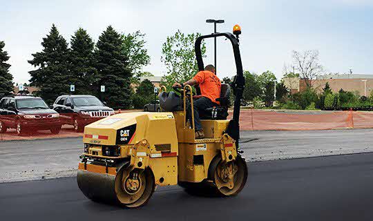
Asphalt driveways tend to be more resilient in severe weather conditions. They’re relatively cheaper to install, giving them an advantage in terms of cost of asphalt vs concrete. A blacktop driveway is typically easier to repair. Thermally, they tend to absorb and hold heat, which can be a determining factor depending on climate and use.
Contrastingly, a concrete driveway offers greater longevity with lower maintenance demand. Concrete has a higher load bearing capacity, better suiting it for heavier vehicles or machinery. It reflects light better thus stays cooler than asphalt, but might not handle harsh winters as well due to its propensity to crack in freeze-thaw cycles.
Asphalt Driveway Cost vs Concrete: An Overview
Cost comparison is a common starting point when choosing between Asphalt and Concrete driveways. Due to lower material costs and faster installation times, asphalt driveways are generally less expensive at the outset. However, concrete’s reputation for durability and longer lifespan might make it more cost-effective in the long run. The actual cost can vary depending on various factors such as customization, installation complexity, and regional variations in material and labor costs.
Concrete vs Pavement Driveway: Considering Other Alternatives
While we’re primarily discussing Asphalt and Concrete, it’s worth noting that alternatives such as paver driveways also exist. Increasingly popular due to their aesthetic appeal, pavers can offer a blend of strength and visual charm. The cost of paver driveway vs concrete can however be considerably higher. It’s important to consider the maintenance needs, installation process, and longevity in addition to driveway concrete vs pavers cost
Driveway Paving vs Concrete: Which is More Sustainable?
Sustainability is an increasingly important consideration, and when considering Asphalt vs Pavers driveway, it’s significant that asphalt is 100% recyclable. When assessing lifespan, one must take into account a material’s longevity and overall environmental footprint. A well-maintained asphalt surface can last anywhere between 15 to 20 years, while concrete if properly installed and maintained can give service of over 30 years. The choice ultimately depends on your specific needs, budget, and environmental considerations.
Conclusion
Choosing between Asphalt and Concrete driveways for your commercial property involves a thorough assessment of your specific needs, budget, climate, and long-term goals. Each comes with its own set of advantages and trade-offs. Be it the cost-efficient approach of an asphalt driveway, or the long-standing durability and visual appeal of concrete driveways, your choice should be matched to the long-term demands and aesthetics of your property. Incorporating these insights should assist you in making a sound choice between asphalt vs concrete, ensuring your construction project comes out on top.
After traversing through this guide, if you’re still unsure about whether asphalt or concrete is the right choice for your driveway, parking lot, or walkway, don’t hesitate to reach out to our experts for advice. We are well-versed on the nitty-gritty of installing both Asphalt vs Concrete surfaces, and would be more than happy to guide you towards the best decision for your commercial property.
Contact Us Today for a FREE
Asphalt vs Concrete Quote

About Roseville, Michigan
History
The first permanent post office in the area was established in 1840 by William Rose who named it “Roseville” in honor of his father Dennison Rose, a veteran of the War of 1812.
The village of Roseville was incorporated in 1926, and the municipal building was constructed in 1929 at Gratiot Avenue and Meier Road. This replaced the Erin Township Building that was built near the corner of 11 Mile Road and Gratiot in 1886. The 1929 building housed administrative offices as well as the police and fire departments until the 1960s, when separate police and fire stations were constructed. City offices remained in the building until 1974.
Michigan’s first commercial airport, Packard Field, opened at Gratiot Avenue and Frazho Road in 1919. It was renamed Gratiot Airport in 1929 and later Hartung Field. The Eastgate Shopping Center was constructed on the site in the 1950s.
The Erin-Roseville Library was established in 1936 in one room of the municipal building. The library moved to its own building in the 1960s and into the newly constructed civic center in 1974. It currently circulates approximately 250,000 items annually.
In 1958, the village and remaining parts of Erin Township were incorporated as the City of Roseville.
An early regional mall, the Macomb Mall, opened in 1964 and is still open today, located west of Gratiot and Masonic.
Geography
Roseville is in southern Macomb County, 14 miles (23 km) northeast of downtown Detroit. It is bordered to the east by St. Clair Shores, to the south by Eastpointe, to the west by Warren, and to the north by Fraser and Clinton Township. Mount Clemens, the Macomb county seat, is 7 miles (11 km) to the northeast.
According to the United States Census Bureau, Roseville has a total area of 9.86 square miles (25.54 km), of which 9.84 square miles (25.49 km2) are land and 0.03 square miles (0.08 km), or 0.27%, are water.
Main highways
 I-94 runs north–south, though still signed east- and westbound, along the eastern edge of the city. Between 10 and 12 Mile Roads, it forms the boundary between Roseville and St. Clair Shores.
 I-696 (Walter P. Reuther Freeway) travels east and west through the middle of Roseville.
 M-3 (Gratiot Avenue) (; named after engineer Charles Gratiot) runs northeast and southwest, and (roughly) bisects the city as it connects Detroit to Mount Clemens and points north.
 M-97 (Groesbeck Highway), named for Governor Alex Groesbeck, is near the western edge of Roseville. It extends northeast from Detroit and is a high-speed and broad diagonal connector to northern Macomb County.
Unnumbered roads
- East–west travel is mainly on the mile roads; that is, 10 Mile Road on the south (Eastpointe, formerly known as East Detroit) border through 14 Mile Road on the north border.
- Utica Road is an important diagonal connector that crosses the city from southeast to northwest, starting at Martin Road, near Gratiot Avenue, and extending to the city’s northern boundary at 13 Mile, then to Fraser, Clinton Township, Sterling Heights and Utica beyond.
Neighboring communities
Demographics
| Census | Pop. | Note | %± |
|---|---|---|---|
| 1930 | 6,836 | — | |
| 1940 | 9,023 | 32.0% | |
| 1950 | 15,816 | 75.3% | |
| 1960 | 50,195 | 217.4% | |
| 1970 | 60,529 | 20.6% | |
| 1980 | 54,311 | −10.3% | |
| 1990 | 51,412 | −5.3% | |
| 2000 | 48,129 | −6.4% | |
| 2010 | 47,299 | −1.7% | |
| 2020 | 47,710 | 0.9% | |
| U.S. Decennial Census | |||
2010 census
As of the census of 2010, there were 47,299 people, 19,553 households, and 12,055 families living in the city. The population density was 4,811.7 inhabitants per square mile (1,857.8/km2). There were 21,260 housing units at an average density of 2,162.8 per square mile (835.1/km). The racial makeup of the city was 83.1% White, 11.8% African American, 0.4% Native American, 1.6% Asian, 0.4% from other races, and 2.6% from two or more races. Hispanic or Latino of any race were 2.0% of the population.
There were 19,553 households, of which 30.9% had children under the age of 18 living with them, 38.3% were married couples living together, 17.4% had a female householder with no husband present, 6.0% had a male householder with no wife present, and 38.3% were non-families. 31.7% of all households were made up of individuals, and 11.6% had someone living alone who was 65 years of age or older. The average household size was 2.41 and the average family size was 3.03.
The median age in the city was 37.9 years. 23% of residents were under the age of 18; 8.9% were between the ages of 18 and 24; 28.3% were from 25 to 44; 26.7% were from 45 to 64; and 13.1% were 65 years of age or older. The gender makeup of the city was 48.4% male and 51.6% female.
2000 census
As of the census of 2000, there were 48,129 people, 19,976 households, and 12,724 families living in the city. The population density was 4,905.6 inhabitants per square mile (1,894.1/km2). There were 20,519 housing units at an average density of 2,091.4 per square mile (807.5/km). The racial makeup of the city was 93.43% White, 2.60% African American, 0.42% Native American, 1.63% Asian, 0.03% Pacific Islander, 0.32% from other races, and 1.57% from two or more races. Hispanic or Latino of any race were 1.50% of the population.
Of the 19,976 households, 28.6% had children under the age of 18 living with them, 46.4% were married couples living together, 12.7% had a female householder with no husband present, and 36.3% were non-families. 30.8% of all households were made up of individuals, and 12.6% had someone living alone who was 65 years of age or older. The average household size was 2.40 and the average family size was 3.02.
In the city, the population was widely diverse, with 23.1% under the age of 18, 8.2% from 18 to 24, 33.0% from 25 to 44, 20.2% from 45 to 64, and 15.4% who were 65 years of age or older. The median age was 36 years. For every 100 females, there were 93.8 males. For every 100 females age 18 and over, there were 90.1 males.
The median income for a household in the city was $41,220, and the median income for a family was $49,244. Males had a median income of $40,113 versus $26,281 for females. The per capita income for the city was $19,823. About 6.1% of families and 7.9% of the population were below the poverty line, including 9.9% of those under age 18 and 5.8% of those age 65 or over.
Government
Roseville has a council-manager government. Voters elect the six council members, mayor, city clerk and treasurer for four-year terms. The terms are staggered so that only three council members are selected in odd-year general elections.
Roseville is located within the 39th Judicial District with the city of Fraser.
Education
Public schools are operated by Roseville Community Schools and Fraser Public Schools. Roseville Community Schools operates seven elementary schools, two middle schools and one high school. Fraser Public Schools operates two elementary schools in the city.
The charter school Conner Creek Academy East is in the city.
St. Angela School of the Roman Catholic Archdiocese of Detroit operated from approximately 1954 until the 2010s.
Contact Us Today for a FREE
Asphalt vs Concrete Quote
Our Asphalt vs Concrete services are available in Roseville as well as all of Macomb County.
Our dedicated team at D&J Contracting Inc is at-the-ready to provide you with great customer service and first class Asphalt vs Concrete services. Reach out to us at (586) 954-0008 to discuss your Asphalt vs Concrete needs today!